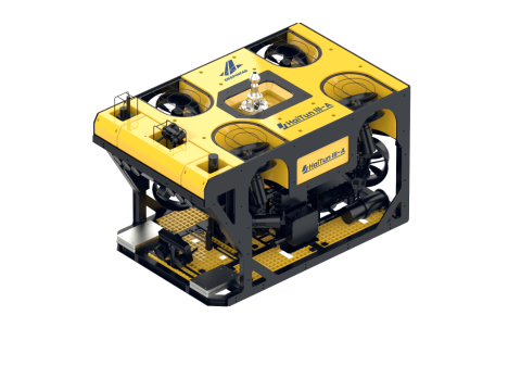
Deepinfar’s intelligent underwater navigation system continues to push boundaries with its advanced polygonal area autonomous planning function—designed to maximize efficiency and precision in underwater missions.
How it works:
This function is powered by Deepinfar’s proprietary navigation algorithms and the integrated navigation suite, which includes:
GPS – for surface location reference
DVL (Doppler Velocity Log) – for accurate underwater movement tracking
INS (Inertial Navigation System) – for orientation and stability in current-heavy environments
Polygonal Area Function Highlights:
Easily draw a custom-shaped area directly on the control map
The ROV will automatically plan the most efficient route
Execute full-coverage autonomous scanning or detection tasks
Applicable Scenarios:
Emergency rescue and search operations
Water conservancy inspections
Marine engineering surveys
Underwater structural mapping & environmental monitoring
With this feature, Deepinfar’s ROVs enable smarter, faster, and more reliable underwater task execution—especially in complex or hazardous areas where precision matters.
Learn more: https://youtube.com/shorts/4qrlAEkljHs?feature=share
 Oil and Energy